
 Feeds from Hilary Baumann & FascinationDesign.com
 Weather feed that uses a set of weather accounts from across the USA / United States / America - currently set to show posts with photos and weather radars only. No text-only posts currently. Feed from @hilarybaumann.com
Feed on BlueskyFeeds Stats
- 💙 Liked by 46 users
- 📅 Updated 9 months ago
- ⚙️ Provider skyfeed.me
Weather🌤️ Radars & Photos Likes over time
Like count prediction
The feed Weather🌤️ Radars & Photos gains approximately 2 likes per month.
Feed Preview for Weather🌤️ Radars & Photos

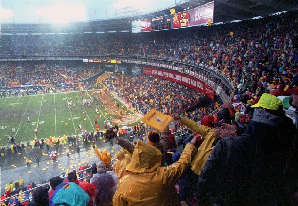
DC and the Commanders announced a deal to build a new stadium at the RFK site. Renderings show a transparent roof, which would eliminate weather impacts inside the stadium. We take this moment, however, to remember one of the most memorable weather-impacted football games at RFK.
More at CWG.live
1
0
32

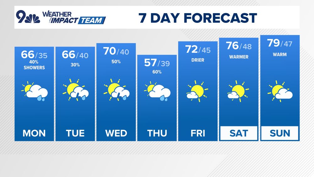
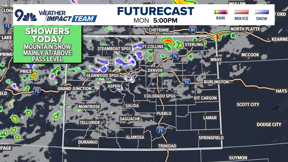
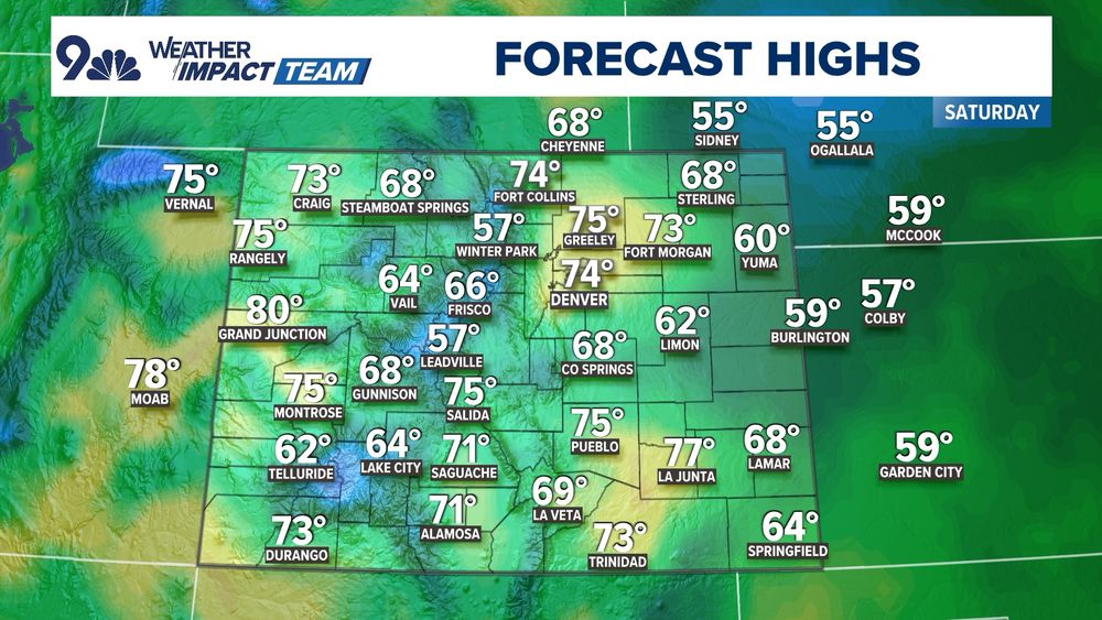
Unsettled through Thursday, but nothing crazy -> highest storm odds Wednesday night with a cold front -> Thursday looks gray/cool -> warm/dry weekend
#COwx
1
1
22
0
0
53
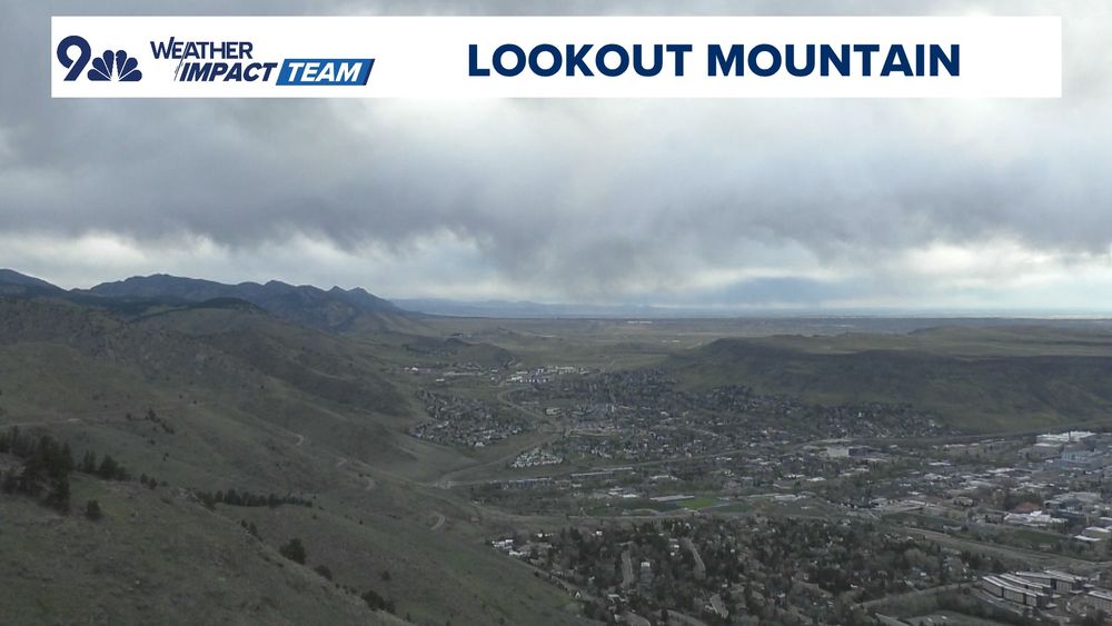
Moody looking skies over Denver this morning...dry low levels means this is mostly bark (virga), not bite.
#COwx
0
0
30
A few showers around the Front Range this morning, better chance this afternoon.
Higher odds for a shower/clap of thunder north of Denver 4-8p. Low/no severe weather risk.
#COwx
0
1
21

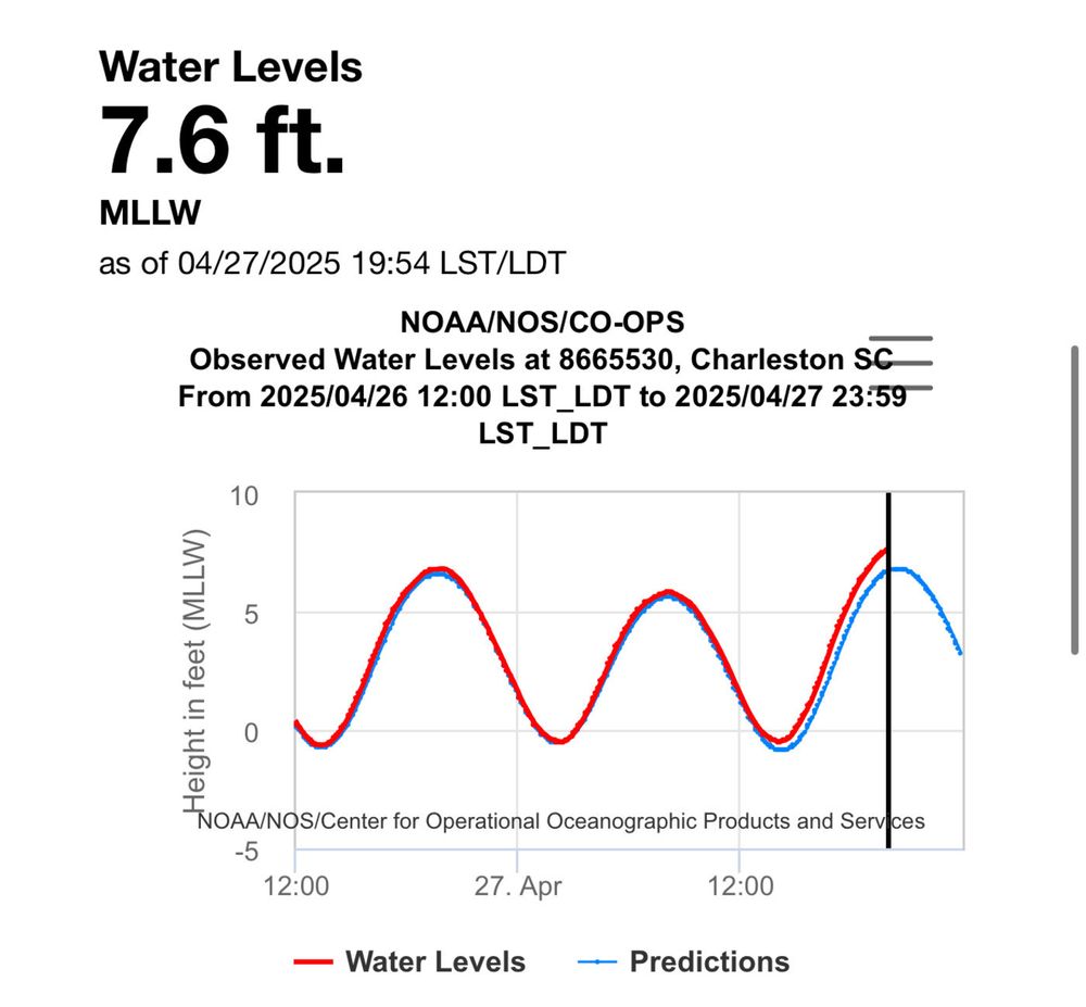
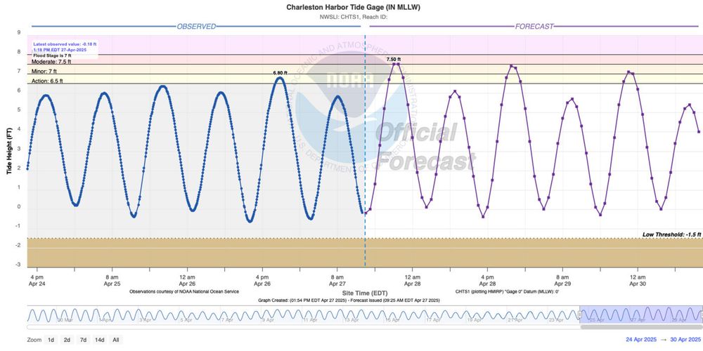
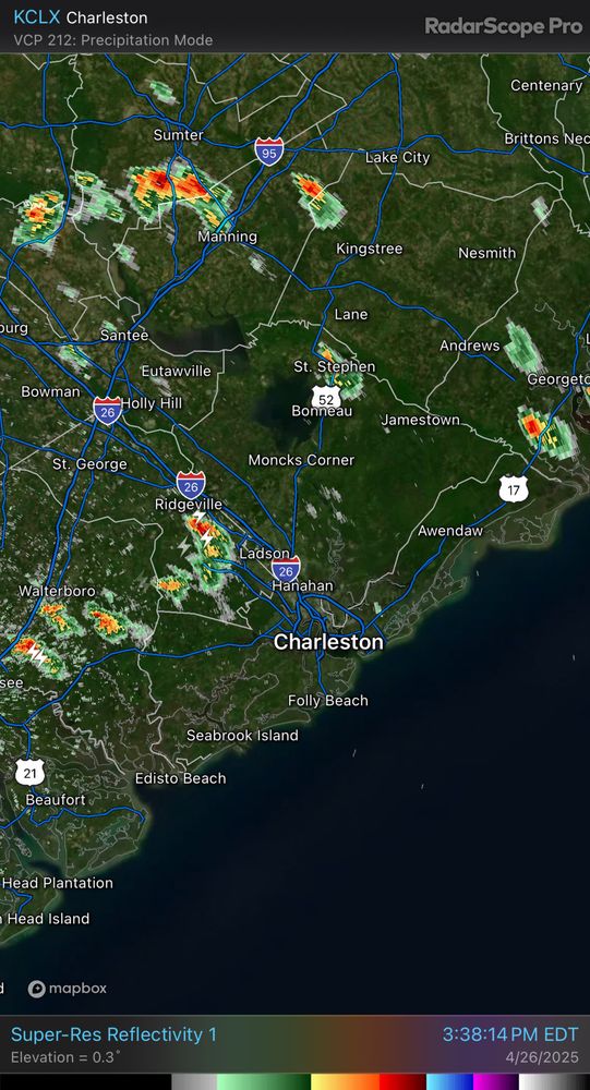
Water levels are well into moderate flood stage in Charleston Harbor. Watch for road closures, and never drive through a flooded road.
0
0
1
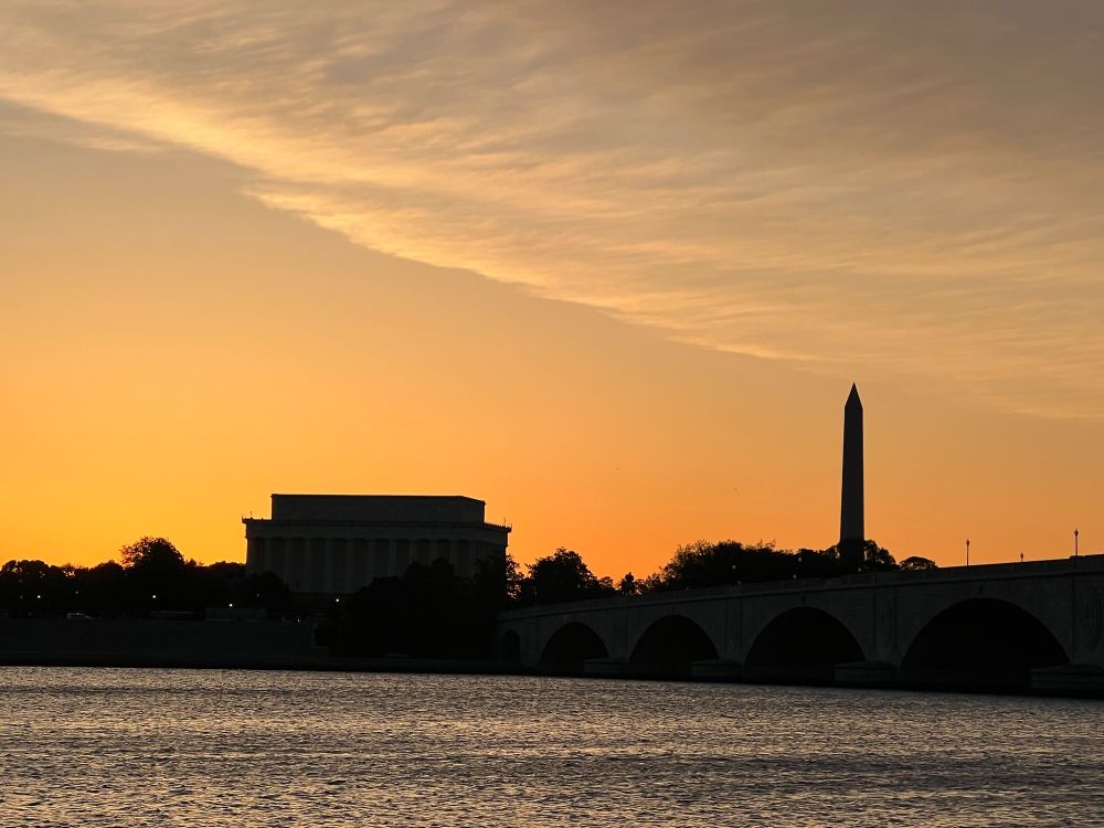
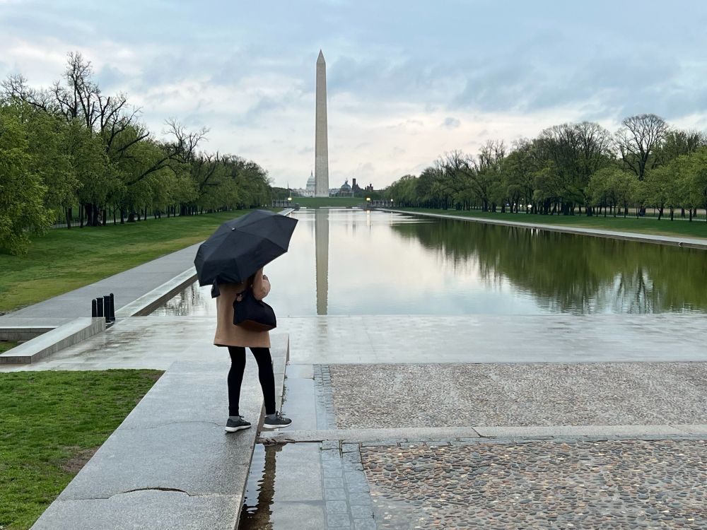
Ahh🧘♀️calming wind in our cwg.live forecast tonight. Fantastic tomorrow--MONDAY😠😅 Reminder, our weekly Sunday Sunset Q&A Live is tonight 7:57 p.m.!
Photo by Jeannie In D.C.
0
4
54
For the first time in quite a while, we have coastal flooding concerns this evening as high tide around 8:33 PM should peak around 7.5’, which is moderate flood stage. Be ready for some road closures if downtown is in your plans this evening.
0
0
2
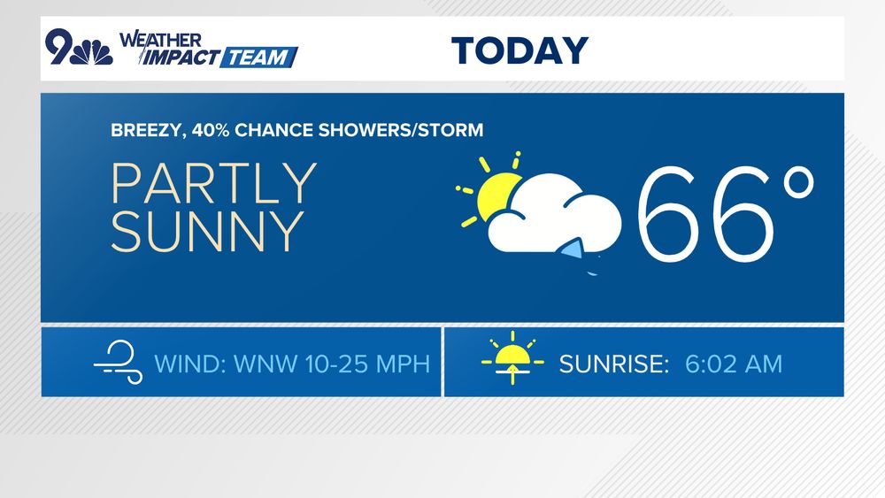
🌡️🔥 Warm, dry and breezy today with a high near 80° in Denver (record: 84°, 1992). There's a Fire Weather Warning for today in the Denver area and most of the Eastern Plains - be smart!
🌦️Cooler (60s) with shower/storm chances returning tomorrow and most of this week.
#COwx
1
2
49
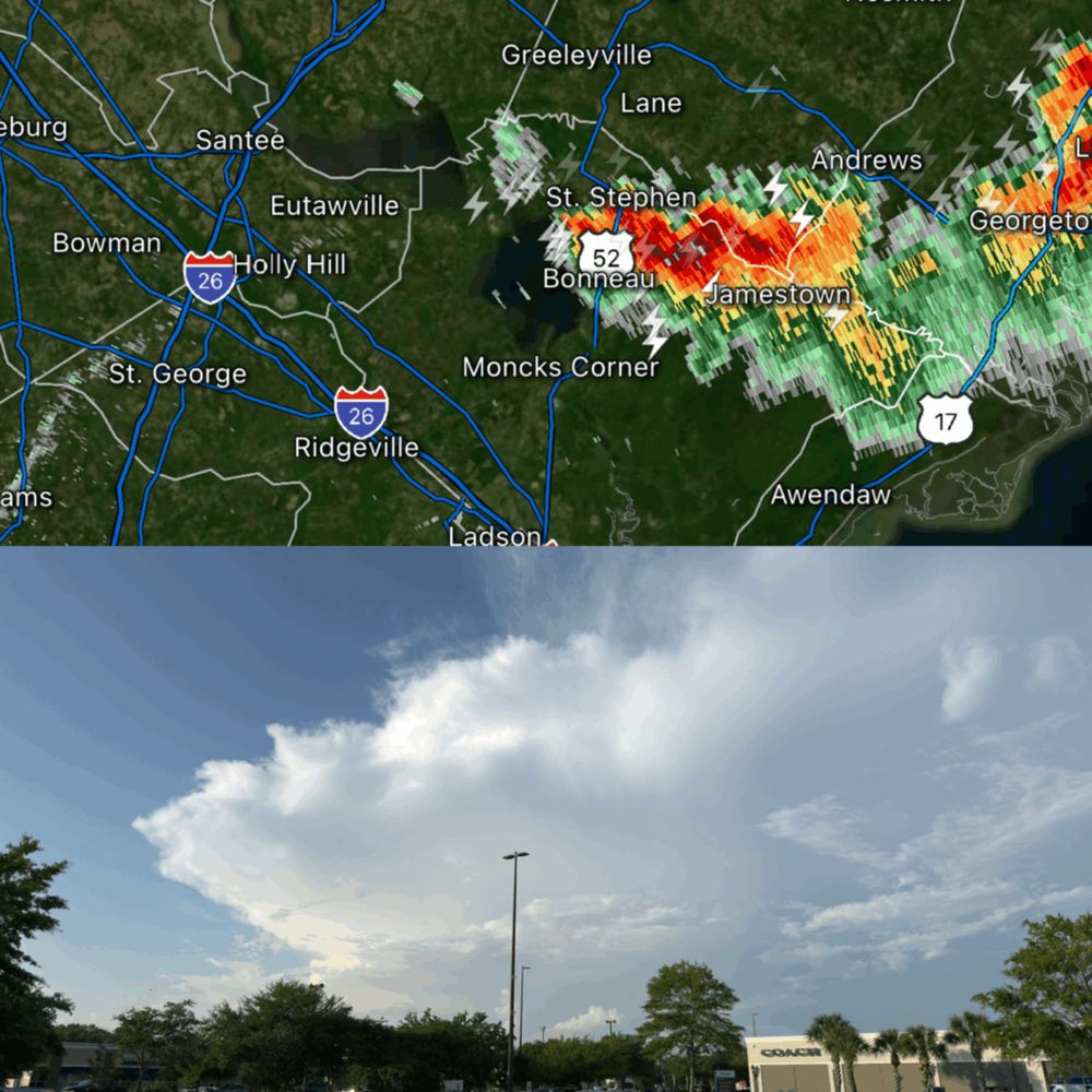
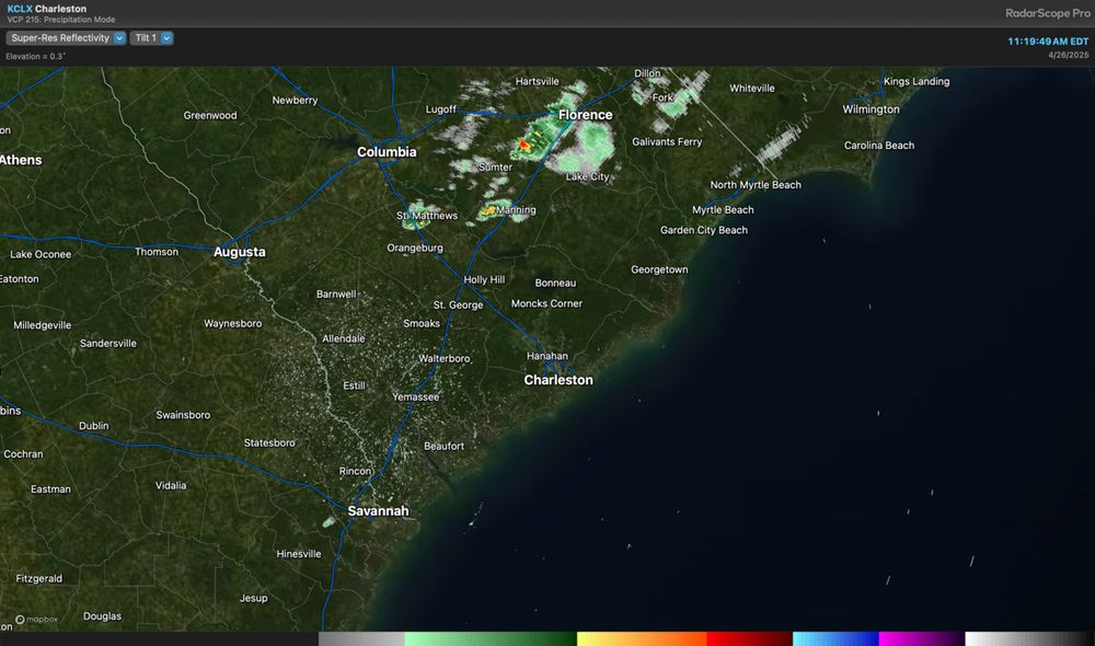
Strong storm over northern Berkeley with heavy rain, lightning, and wouldn’t rule out a few pings of small hail, either. Good-looking storm visible from North Charleston!
0
0
1
Watching exiting storms at cwg.live with wind set to move in behind them this evening. Gusts last into tomorrow, an otherwise sunny Sunday, highs near 70. Blowing pollen🤧though.
Photo by Jeannie In D.C.
2
9
54
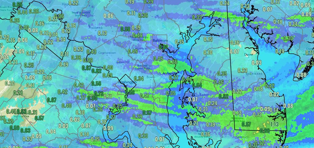
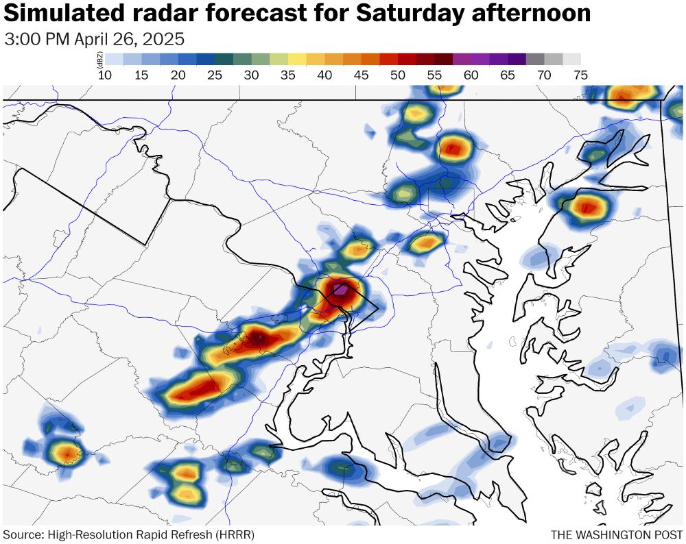
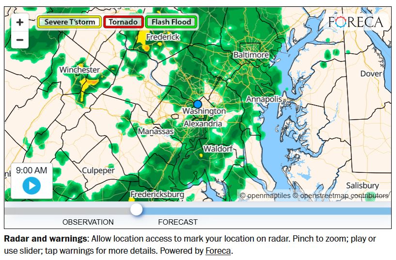
Showers and thunderstorms are developing and moving eastward across parts of the area this afternoon. Stay alert for approaching storms and be ready to move indoors, especially if you hear thunder or see lightning.
2
0
3
Some storms forming this afternoon as a cold front arrives.
2 to 5 p.m. for best odds of a strong storm locally. Brief heavy rain, small chance of severe, then clearing and gusty this evening. Details at updated cwg.live.
2
4
37
Generally quiet but cloudy across the Tri-County this morning, though we should see an uptick in shower and thunderstorm activity this afternoon into this evening as the seabreeze pushes in. A strong storm or two can’t be totally ruled out. Stay alert especially at High Water!
0
0
0
🌤️ Patchy morning fog/clouds break up quickly this morning, with a high in the mid-70s. Clouds increase this afternoon with a 20% chance for a brief gusty storm 3-7p, most stay dry.
🌡️ Warmer tomorrow (80s) before a cooler Monday with a chance for showers and storms.
#COwx
0
1
30
Today’s daily digit — 5/10: It won’t rain all day but it’s enough rain to mess with things. Then wind late.
See the latest radar and forecast @ cwg.live
3
2
27